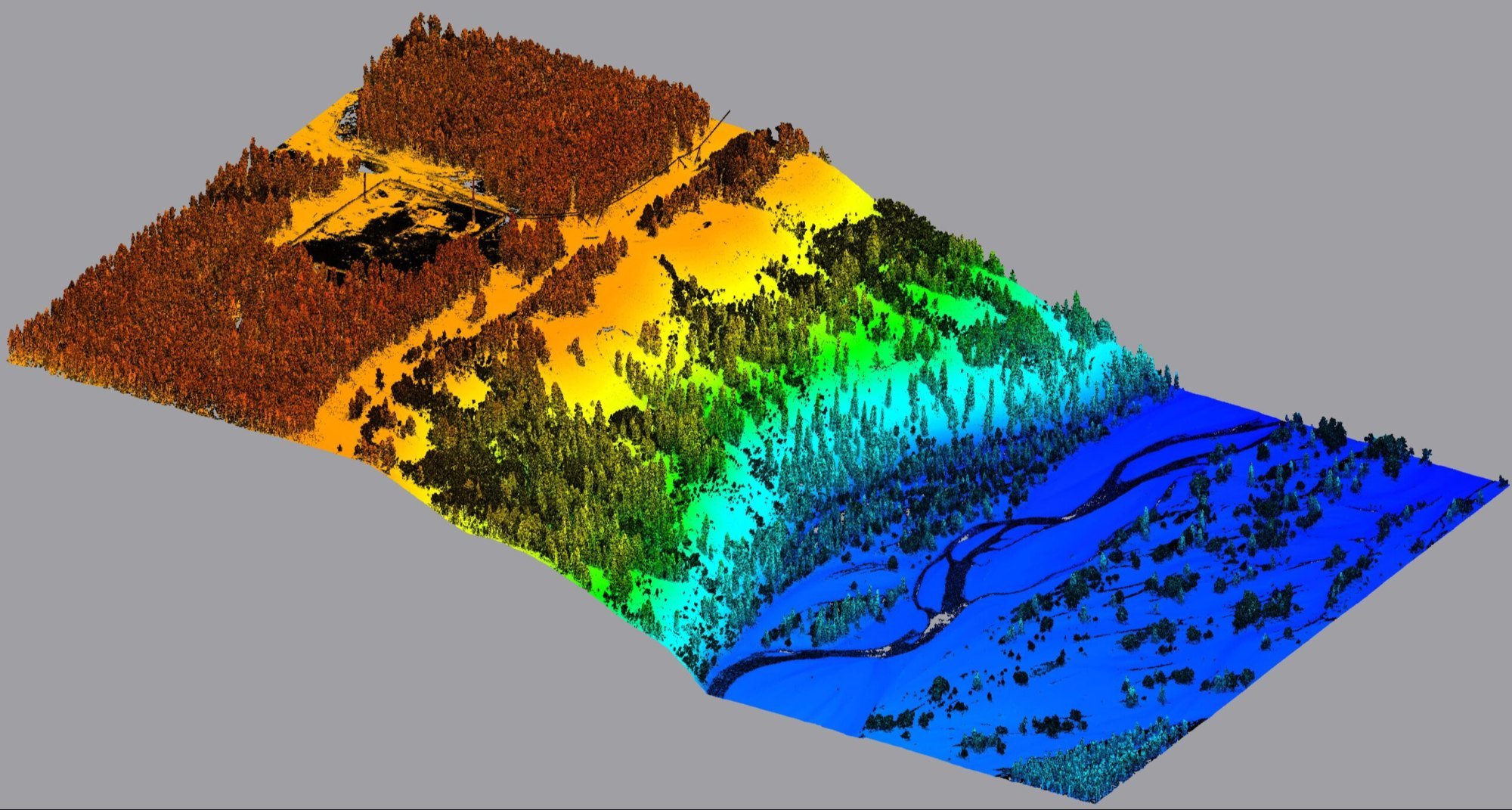
"Terrain Analysis" - LiDAR Project
Category: Geoscience
Short Description: Utilize LiDAR technology to analyze the terrain of a large area, creating high-resolution 3D models and identifying geological features such as slopes, valleys, and ridges. The project aims to provide
Ground-Penetrating Radar (GPR)
Category: Geoscience
Short Description: Ground-Penetrating Radar (GPR) is a non-destructive technology that uses radar pulses to image the subsurface of the earth. It is used to study the subsurface geology, locate underground structures,